skip to main |
skip to sidebar
The Ayala Center is a commercial development operated by Ayala Land located in the central business district of Makati, Metro Manila, Philippines.
The Ayala Center is a business, recreational, shopping, dining, and entertainment development located in Barangay San Lorenzo in Makati, at the corner of two major thoroughfares, Ayala Avenue and Epifanio de los Santos Avenue (EDSA), in Makati's central business district. Its location places it virtually at the heart of the country's commercial and business center. The Ayala Metro Rail Transit (MRT) station serves the area. The development originally started with a number of separate shopping arcades and Greenbelt Park before expanding to cover over 50 hectares[citation needed] of facilities. Today the complex now includes several malls, each with its own shopping and restaurant arcades and cinemas; three department stores, a number of hotels; and the Ayala Museum, showcasing exhibits on Philippine history and art.
Fort Santiago (Spanish: Fuerza de Santiago Tagalog: Moog ng Santiago) is a citadel first built by Spanish conquistador, Miguel López de Legazpi for the new established city of Manila in the Philippines. The defense fortress is part of the structures of the walled city of Manila referred to as Intramuros ("within the walls").
The fort is one of the most important historical sites in Manila. Several lives were lost in its prisons during the Spanish Colonial Period and World War II. José Rizal, the Philippines' national hero, was imprisoned here before his execution in 1896. The Rizal Shrine museum displays memorabilia of the hero in their collection and the fort features, embedded onto the ground in bronze, his footsteps representing his final walk from his cell to the location of the actual execution.

The location of Fort Santiago was once the site of a palisaded fort, armed with bronze guns, of Rajah Sulaiman, a Muslim chieftain of pre-Hispanic Manila. It was destroyed by maestre de campo (master-of-camp) Martin de Goiti who, upon arriving in 1570 from Cebu, fought several battles with the Islamic natives. The Spaniards started building Fort Santiago (Fuerza de Santiago) after the establishment of the city of Manila under Spanish rule on June 24, 1571, and made Manila the capital of the newly colonized country.
The first fort was a structure of palm logs and earth. Most of it was destroyed when the city was invaded by Chinese pirates led by Limahong. Martin de Goiti was killed during the siege. After a fierce conflict, the Spaniards under the leadership of Juan de Salcedo, eventually drove the pirates out to Pangasinan province to the north, and eventually out of the country.
The construction of Fort Santiago with hard stone, together with the original fortified walls of Intramuros, commenced in 1590 and finished in 1593 during the reign of Gómez Pérez Dasmariñas. The stones used were volcanic tuff quarried from Guadalupe (now Gualupe Viejo in Makati).[6] The fort as Dasmariñas left it consisted of a castellated structure without towers, trapezoidal in trace, its straight gray front projecting into the river mouth. Arches supported an open gun platform above, named the battery of Santa Barbara, the patron saint of all good artillerymen. These arches formed casemates which afforded a lower tier of fire through embrasures. Curtain walls of simplest character, without counter forts or interior buttresses, extended the flanks to a fourth front facing the city.
During World War II, Fort Santiago was captured by the Japanese Imperial Army, and used its prisons and dungeons including the storage cells and gunpowder magazines for hundreds of prisoners who were killed near the end of the war (see Manila massacre).[9] The fort sustained heavy damage from American and Filipino mortar shells during the Battle of Manila in February 1945.
Fort Santiago, the 16th century military defense structure, stands witness to the valor and heroism of the Filipino through the centuries. Today, the fort, its bastions, and the prison dungeons for criminals used by the Spanish officials, is now part of a historical park which also includes the Plaza del Moriones (also called the Plaza de Armas) and several ruins. The park houses well-preserved legacies from the Spanish Colonial Period including Jose Rizal memorabilia at the Rizal Shrine.
Adaptive use of this famous historical landmark makes certain areas ideal for open air theater, picnics, and as a promenade. The Intramuros Visitors center gives an overview of the various attractions in the walled city.
After is destruction during WWII, Fort Santiago was declared as a Shrine of Freedom in 1950. Its restoration by the Philippine government did not begin till 1953 under the hands of the National Parks Development Committee. The Intramuros Administration now manages the reconstruction, maintenance and management of the fort since 1992.
Hanging coffins are coffins which have been placed on cliffs. They can be found in various locations, including China, Indonesia, and the Philippines. In China, they are known as Xuanguan (simplified Chinese: 悬棺; traditional Chinese: 懸棺; pinyin: Xuánguān) which also means "hanging coffin".
Hanging coffins are an ancient funeral custom of some minority groups, especially the Bo people of southern China. Coffins of various shapes were mostly carved from one whole piece of wood. Hanging coffins either lie on beams projecting outward from vertical faces such as mountains, are placed in caves in the face of cliffs, or sit on natural rock projections on mountain faces.
It was said that the hanging coffins could prevent bodies from being taken by beasts and also bless the soul eternally.
The Hanging Coffins of Sagada is definitely one of the most popular tourist spot in Mountain Province. Visiting this old world burial site only involves a short hike but one thing more interesting is you will have to pass by an American influenced cemetery which is located on a hilltop called Echo Valley.
Trekking to the hilltop was a chilly and easy journey but seeing a Globe Telecom Cell Site right at the back of the Calvary replica was rather disappointing. After just a short walk down to the place called Echo Valley, the disappointment we had was eased after seeing the magnificent view of Sagada’s rocky village and the jaw-dropping view of the Hanging Coffins.
Bangui Wind Farm is a wind farm in Bangui, Ilocos Norte, Philippines. The wind farm uses 20 units of 70-metre (230 ft) high Vestas V82 1.65 MW wind turbines, arranged on a single row stretching along a nine-kilometer shoreline off Bangui Bay, facing the South China Sea.
The Northwind Bangui Bay Project is located at the municipality of Bangui, Ilocos Norte, Philippines. Located at the north-west tip of Luzon island.
Phase I of the NorthWind power project in Bangui Bay consists of 15 wind turbines, each capable of producing electricity up to a maximum capacity of 1.65MW, for a total of 24.75MW.
Phase II, was completed on August 2008, and added 5 more wind turbines with the same capacity, and brought the total capacity to 33MW. All 20 turbines describes a graceful arc reflecting the shoreline of Bangui Bay.
Mount Pinatubo is a volcano known for producing the second largest terrestrial eruption of the twentieth century. Pinatubo lies at the intersection of the borders of Zambales, Tarlac and Pampanga and was covered with lush forest growth prior to the eruption. It had also supported several thousand Aeta. The volcano's eruption in June 1991 caused the destruction of billions of pesos' worth in economic and property damage and the loss of 847 lives. Aside from the massive damage to the Philippine economy, the eruption also had world-spanning ramifications.
The violent explosion on the 15th of June in 1991 broke away a big part of the top of the Pinatubo. The summit of the volcano collapsed into the under laying magma chamber. The result was an enormous depression, the caldera, with a 2.5 kilometre diameter!
The new summit of the volcano was 145 meters lower than before the explosion.
On the northernmost part of Bicolandia is an unknown paradise that can rival the white sand beach of Boracay and the serenity of Pagudpud, still virgin and unspoiled- the beautiful and enchanting islands of Calaguas.
Calaguas is a group of islands in the Pacific under the jurisdiction of the town of Vinzons, Province of Camarines Norte, a merely two hour boat ride from the mainland. It boasts of powdery white sand beaches, crystal-clear waters, and unspoiled natural resources, a place where you can truly relax while enjoying the beauty and serenity of the place.
The long stretch of beach named Halabang Baybay/Mahabang Buhangin (Long Beach) by the locals, is a cove located in the Tinaga Island, it is a picture perfect paradise with its long stretch of fine white sand, dotted with volcanic rocks on its both ends, the place is the most frequented camping and swimming site by tourists.
Discover Calaguas Group of Islands, swim on its turquoise water, sit on its white sand, enjoy its magnificent view of sunset, explore its beauty… you’ll definitely find a reason to be happy.
How to Get There:
While there are travel/tour organizers offering Calaguas tour, a DIY trip is possible and the cheapest way to get to the island. The experience of doing it on your own for the entire journey adds thrill and excitement to what is already an exciting adventure.
Via Vinzons
Daet, the capital of Camarines Norte is the jumpoff point to Calaguas Islands if you are going there via Vinzons. From there catch a jeeney to Vinzons and get off at the fishport (pandawan). There’s a boat going to Barangay Banocboc daily, it departs the fishport at 11 AM, from Banocboc you can hire a banca to take you to Calaguas Islands for as low as P500.00 or even lower depending on your haggling skill. The return trip to Vinzons fishport leaves Banocboc at 6AM the next day.
Alternatively, you can hire a banca from Vinzons fishport to Calaguas Islands, price depends on the capacity of the boat. For a small boat that can fit four to five people, the lowest rate is at P2500-P3000.00. It is a two hour boat ride from the port.
SAGADA, MOUNTAIN PROVINCE – Sagada is famous for its hanging coffins, owing to traditional belief that the dead are better buried above ground since this allows their souls to freely wander near loved ones.
But for starters, a visit to the Lumiang Burial Cave allows you to peruse coffins at an arm’s length.
To get to Lumiang, you need to walk about half an hour from the twon square. As we trooped downhill to our destination, our guide Mang Lodong directed our attention to gigantic human-shaped stone formations on each side of the road.
It somehow welcomed me to what seems to be a gloomier side of Sagada. We didn’t have to get to the Lumiang Cave to see the hanging coffins.
Halfway through our hike, we passed by towering rock formations where you can see the hanging coffins, almost unnoticeable if not for tourists we saw taking photos.
To reach the cave’s mouth, we had to walk down some 500 meters, a railing aiding us down the slippery slope.
The entry point for the cave connection was pitch-black. Mang Lodong said the entrance is deceptively deep. It felt weird being in a burial cave but between that and a risky stunt, I felt the former was a lot safer.
I wasn’t fully comfortable with the thought of being around the dead and the eerie feeling inside the cave didn’t help. Good thing Mang Lodong started his semi-lecture about the burial cave.
The Lumiang Cave houses at least 200 coffins that have been there for 500 years. Mang Lodong said family members or friends of the dead would pass and take turns in transporting the coffin to the cave. They believe that when the one that carries the coffin is stained with the dead’s blood, he gains good fortune and blessings in life.
It was noticeable that the coffins were a little small for a full-grown adult. Mang Lodong explained that the dead should be forced to a fetal position in order to fit in the coffin. He added such is the way the dead “took form” which means it is only right that he “rests” in the same position.
While most of the coffins are piled one after another, there are also coffins tucked in the highest upper corners of the cave wall. It is unthinkable how the families were able to get the coffin all the way up there but Mang Lodong said, these families’ effort signifies their love for the deceased.
According to Mang Lodong, when Sagadians reach old age, they take the initiative to make their own coffins. When they die, their family members tuck the coffin in the highest part of the cave first; the body then follows as the family members lay it in its final resting place.
This is also done to keep the bodies away from stray dogs and wild animals who hunt in the cave. Some of the coffins which have carvings of a gecko (the reptile Sagadians revere for guarding their harvests) are those which Mang Lodong described as highly-respected leaders.
In modern times, Sagadians have adapted the virtue of burying and visiting the tombs of the dead in a cemetery. However, those who have loved ones buried in the burial cave of Lumiang do not visit the cave. Instead, they perform rituals at home.
We trooped back up only to discover that on the opposite side of the road was another burial cave. Mang Lodong said this area is the burial place of women who died out of pregnancy or infants who died of illness.
All in all, the trip to the Lumiang Cave was worth it. Sure it wasn’t half as fun as the adrenaline rush I would’ve felt with the cave connection activity but at least I had another reason to visit Sagada again.

Paoay Church is the Roman Catholic parish church of the municipality of Paoay, Ilocos Norte in the Philippines. Completed in 1710, the church is famous for its distinct architecture highlighted by the enormous buttresses on the sides and back of the building. In 1993, the church was designated as a UNESCO World Heritage Site as one best examples of the Baroque Churches of the Philippines.
Paoay church is prime example of Earthquake Baroque architecture, which is the Philippine interpretation of the European Baroque adapted to the seismic condition of the country. Destructive earthquakes are common and have destroyed earlier churches all throughout the country.[1] Aside from Baroque, the church facade also exudes Javanese architecture reminiscent of Borobudur of Java.
The town of Paoay was originally called "Bombay" as the earliest inhabitants believed to have come from India. The earliest historical record of the area dates back to 1593, becoming an Augustinian independent parish in 1686. Building of the present church was started in 1694 by Augustinian friar Father Antonio Estavillo, and it was completed in 1710.
Enchanted Kingdom is a theme park in the Philippines. It is located in Santa Rosa City, Laguna, about 29 kilometers (18 mi) from Manila. It has a land area of 17 hectares (41 acres). The park is managed and operated by Enchanted Kingdom Inc.
Enchanted Kingdom is a member of the International Association of Amusement Parks and Attractions (IAAPA).
The park was conceptualized by the Landmark Entertainment Group and modeled after Knott's Berry Farm. It was built at a cost of P1.2-billion. The park first opened on July 28, 1995.
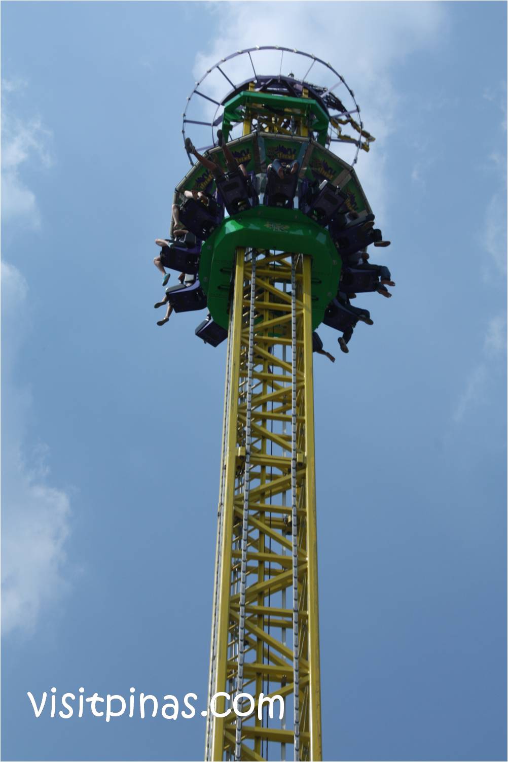
The Regular Day Pass ticket is Php 600 on weekends and Php 500 on weekdays. Recommended rides are the following; Disk-O-Magic, Rio Grande Rapids, Jungle Log Jam, Space Shuttle. At EKstreme it is best to try at night. Wheel of Fate, Flying Fiesta and many more.
The Victoria Park is inspired by the era of Queen Victoria's rule and displays it in elegance. There are entertainers and mascots in this area of the park and, most notably, one of the entertainers found is Eldar, the mascot of Enchanted Kingdom.
Enchanted Kingdom opened to the public on October 19, 1995. It was and still is the Philippines first and only world class theme park. The theme park boasts of rides and attractions unique to the country and in size and magnitude that had never been experienced before. Locating these rides and attractions within seven meticulously theme zones interspersed with food and merchandise outlets and kiosk as well as various game stands also added to the "enchanting experience", away from the day-to-day realities of life.
Matukad Island is one of the small islands found in Caramoan, Camarines Sur.
Matukad Island is pristine or unspoiled by commercialism. It has powder-like fine white sands, and schools of fish swimming are abundant in the area. The Island also has a hidden lake inside the rock formations in the island.
How to Get there:
From Manila take Buses bound to Naga City, Cubao central bus terminal caters buses bound to Bicol Daily, note that trips going to Bicol region starts at 6pm-11pm daily. From Manila to Naga trip will take 8 hours. Once you are in Naga City Central Bus Terminal walk outside you will see the Jeepney and Van Terminal Bound to different Municipalities. Look for vans or jeeps bound to Sabang Pier take note all vans and Jeepney’s have limited trips in the morning only fare is 60-70 pesos. From Sabang Pier you will need to board the motorized banca bound to Guijalo Pier fare is 120 per head as of March 10, 2008 , once you are in Guijalo Pier board a tricycle to take you in Centro ( Central Town of Caramoan) find a place to stay, there are 4 choices to choose from Rex Tourist Inn. La Casa Roa, Villa Julianna and Lodge Inn. The next day charter a tricycle to take you to port of Bikal hire a boat which will take you the surrounding islands of Caramoan, Boat rental is 1,500 whole day good for 4-5 heads. Going to the islands are free there are no resorts or any restaurant so make sure to bring your packed lunch and snacks during the tour. Just a reminder to all tourist please keep those islands as clean as possible always keep your trash do not leave them in the islands.


Corregidor Island, locally called Isla ng Corregidor, is a lofty island located at the entrance of Manila Bay in southwestern part of Luzon Island in the Philippines. Due to this location, Corregidor was fortified with several coastal artillery and ammunition magazines to defend the entrance of Manila Bay and the City of Manila from attacks by enemy warships in the event of war. Located 48 kilometres (30 mi) inland, Manila has been the largest city and the most important seaport in the Philippines for centuries, from the colonial rule of Spain, the United States, and Japan and after the establishment of the Republic of the Philippines in 1946.
Corregidor (Fort Mills) is the largest of the islands that formed the harbor defenses of Manila Bay together with El Fraile Island (Fort Drum), Caballo Island (Fort Hughes) and Carabao Island (Fort Frank), which were all fortified during the American occupation of the country. The island was also the site of a small military airfield, as part of the defense.
During World War II, Corregidor played an important role during the invasion and liberation of the Philippines from Japanese forces. Heavily bombarded in the latter part of the war, the ruins left on the island serve as a military memorial to American, Filipino and Japanese soldiers who served or lost their lives on the island. Corregidor is one of the important historic and tourist sites in the country.
Corregidor and Caballo islands are remnants of a volcanic crater, the Corregidor Caldera, which was last active about one million years ago. However, the Philippine Institute of Volcanology and Seismology still classifies Corregidor as a potentially active volcano.
There were 65 miles (105 km) of paved roads and trails on the island and 19.5 miles (31.4 km) of electric railroad track. The latter were used largely to haul heavy equipment and ammunition from Bottomside to the different Batteries. The Corregidor High School was where children of both Filipino and American servicemen assigned on the island studied. The island also had an electric trolley system as public transport, a movie house (Cine Corregidor), a baseball field and a swimming pool. The business and social center of this community was found on Topside.
There were 23 batteries installed on Corregidor, consisting of 56 coastal guns and mortars. In addition, Corregidor had 13 anti-aircraft artillery batteries with 76 guns (28 3-inch and 48 .50-caliber) and 10 60-inch Sperry searchlights.
The longest-range coastal pieces were the two 12-inch (305 mm) guns of Batteries Hearn and Smith, with a horizontal range of 29,000 yards (27,000 m). Although capable of an all around traverse, these guns, due to their flat trajectories, were not effective for use against targets on Bataan.
During the siege, the island had ample armor-piercing ammunition but very little of the anti-personnel type, which then was of greatest demand for use against land targets on Bataan. In fact, most of the anti-personnel shells were only for the 12-inch mortars of Batteries Way and Geary.